")
")
")
")
")

")

Gibraltar
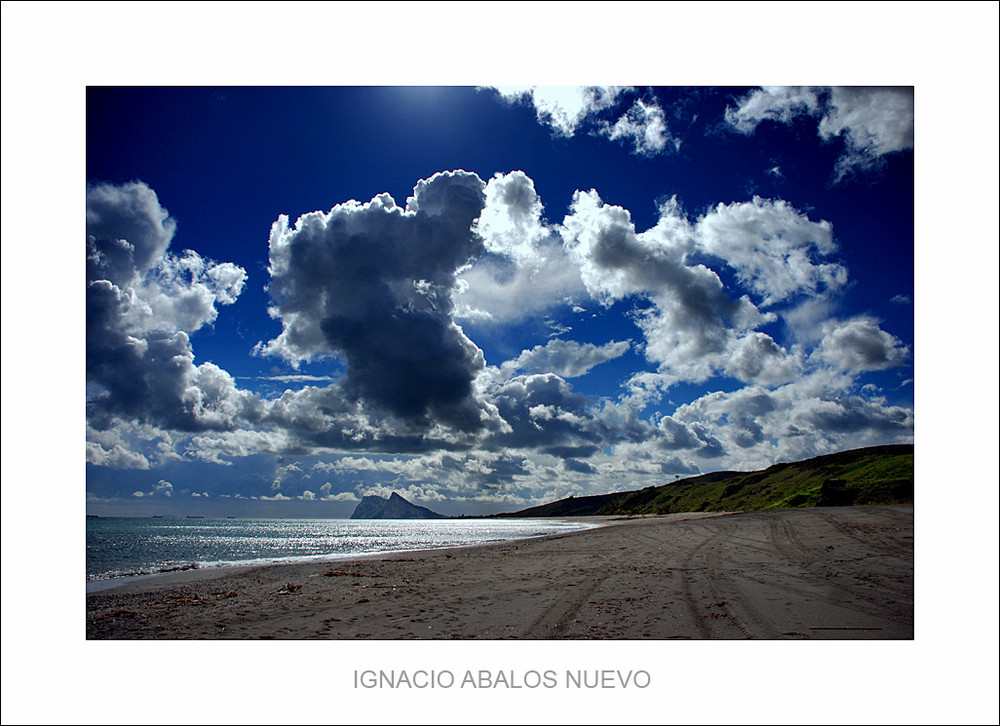
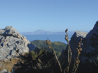
The rugged Jebel Tarik, Tarik mount, as the Arabs called the Rock of Gibraltar, hidden under his bowels, many cavities first settlers took refuge and miles of rock-cut man with the passing of the centuries tunnels. Today, this limestone mass, converted into a nature reserve, home to precious wildlife, especially punctuated by friendly monkeys who try to gain ground man. At his feet, in the Mediterranean, the dolphins play to "surround" the rock. While in the city, the commercial bustle begins early in the morning. Hodgepodge of cultures and styles, Gibraltar is a special place in the Iberian Peninsula, where the rock acts as a spectacular view of the African coast.
| How to get, |
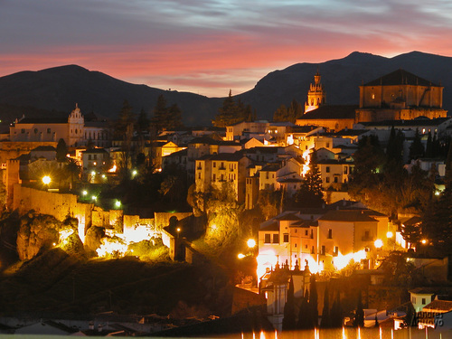
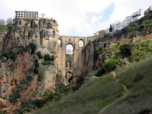
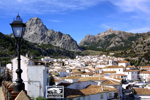
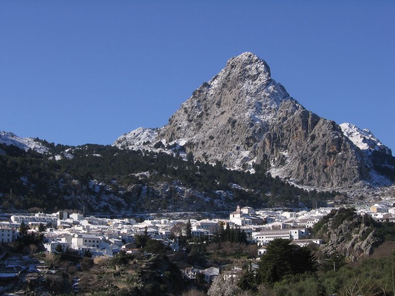
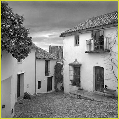
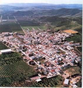
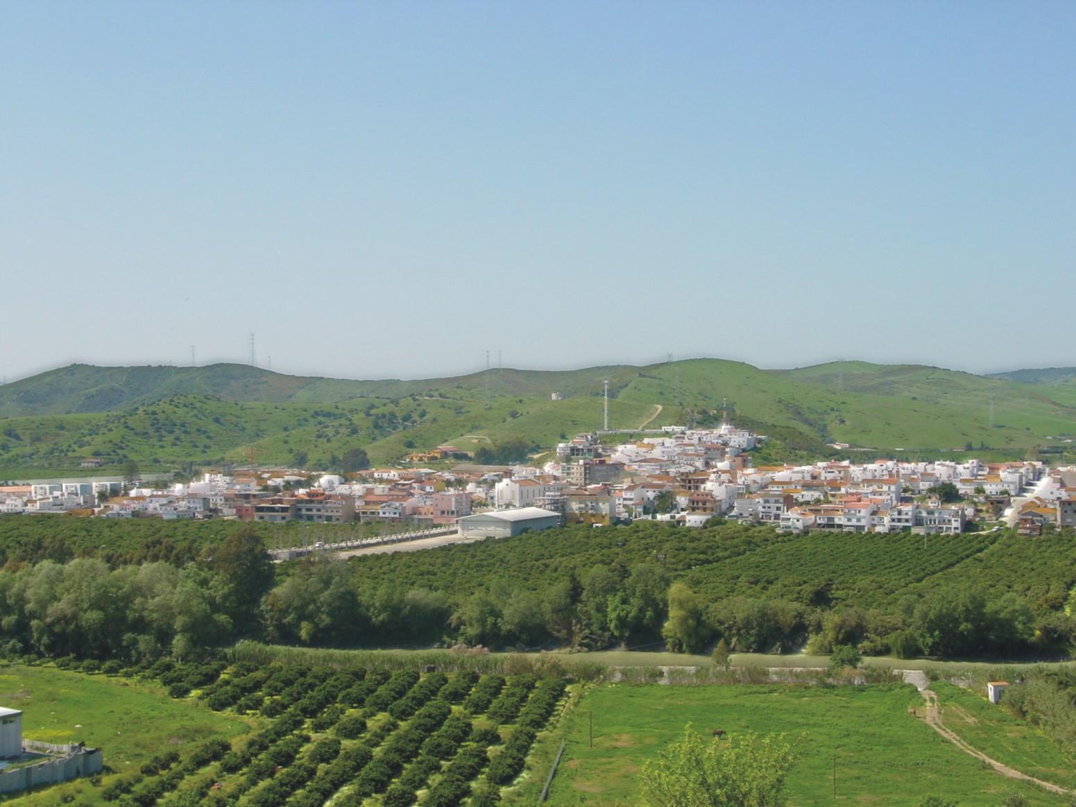
Ronda

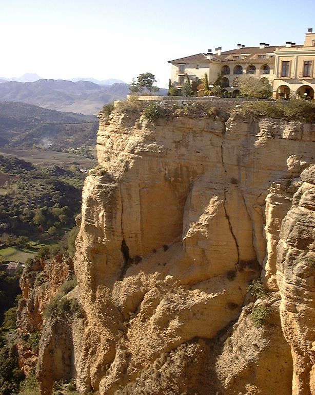
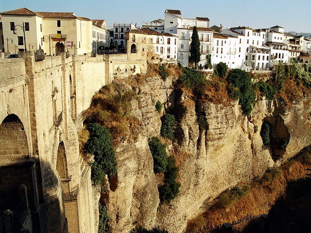
There are cities that appear in the eyes of the traveler as something unreal. We rub our eyes and emerge from cliffs and gorges, intimate and secluded, to give us good morning and make us dream of his past bullfighters and bandits. This is Round. Magical, fascinating, shoulder and bolero.
Its streets keep silent many stories of stolen affair, romantic legends dressed for battle in their mountainous, home to many famous bandits. Spot the Tajo de Ronda us back to those times of violence but also of loyalty, of betrayal but also of forbidden love. And ran its many pubs and bars we can even imagine José María "El Tempranillo" or Juan José Mingolla "long steps", famous outlaws, chatting, laughing, good jug of wine and a loaf of bread in her hands, cut with their large knives.
Romantic and tragic times that have managed to leave us a no less romantic city.
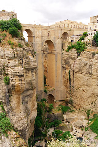
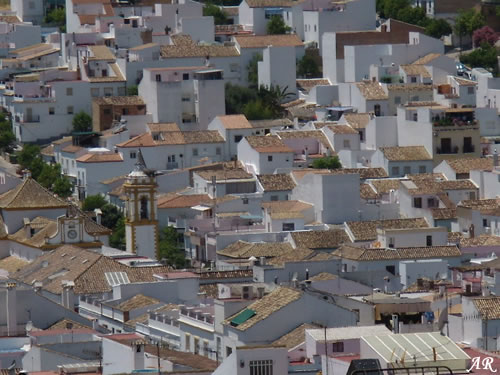
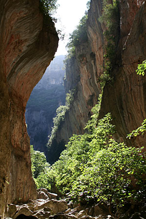
Ronda is the head of a region rich in monuments and Nature. The Guadalevin through the city to divide it in two and carving on it for centuries, which today is its most famous and beautiful appearance: the famous Tajo de Ronda, a wildlife conservation work, a deep gash cut into the mountain, more than hundred meters deep, is now the hallmark of this mountain town.
To each side are two different cities. On the one hand the new, happy and set their city outstanding monumental bullring that has been so historical runs, and that has made Ronda bullfighting city.
And on the other side, the old, nostalgic, beautiful, quiet, full of palaces and churches, cozy places, like the Duchess of Parcent, with the church of Santa María de la Encarnación and the City Council.
In Ronda, white and bright, you can see its Arab art in its minarets or towers at Casa Moro king, among other palaces, but also Baroque, Gothic and Renaissance riches, as the door of Carlos V, located in the wall ...
| Monumentos | |
|
Alameda del Tajo |
Iglesia Convento de la Merced |
Gastronomy
Ronda has a great gastronomic tradition, emphasize its game dishes, pumpkins to Ronda, migas with chorizo, porridge, beans with tomato, garlic and ham, beans with sausage, soup almonds and artichokes, gazpacho to the mountain, the tortilla rondeña, lamb stew, etc.
As for the pastries are famous Tagus yolks and sweet nuns the convents of the city are made.
| Cómo llegar, |
{yoogallery src=[/images/azahar/ronda/] height=[141]}
![]()
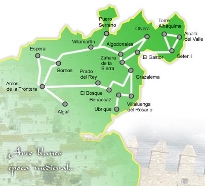
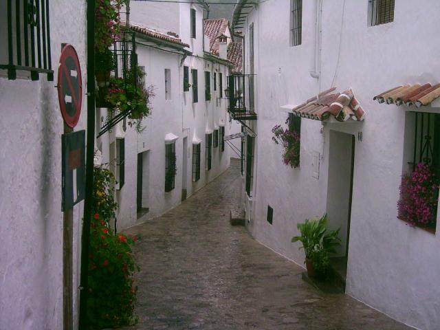
Ruta Pueblos Blancos

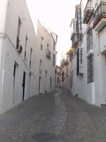
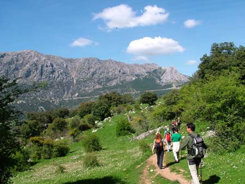
This route, one of the most classical and popular in Andalusia, consisting of more than 20 municipalities in the provinces of Cadiz and Malaga. Towns and cities have in common with those houses whitewashed walls so characteristic of much of Andalusia. An excuse to visit and enjoy the rich and diverse historical, cultural and natural heritage that are stored inside each and every one of the places that make this tourist offer. Churches of different architectural styles from different eras archaeological sites, castles, prehistoric caves, museums and natural areas ... as important as the Natural Park of bedrooms or the Sierra de Grazalema Natural Park are just some of the gems that we find in our journey .
We may also use the occasion to taste the delicious dishes of the cuisine of these municipalities, such as trout Forest; buy products from the local crafts as known Grazalema blankets, leather goods Ubrique and Prado del Rey or the famous guitars Algodonales, and use the wide range of leisure and sports that are in these locations: Mount riding, hiking or also in Algodonales, paragliding and hang gliding.
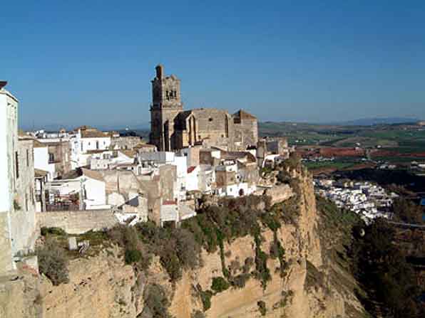
Arcos de la Frontera we find such beautiful monuments such as the Basilica of Santa Maria, the Ducal Palace or Castle of the Estate House, Cultural House today the municipality; in Bribes, Fontanar the Castle, also known as the Palace of the Bank or the Convent of Corpus Christi, among others; Waiting, the Church of Santa María de Gracia or Fatetar Castle on the mountain of the same name; and Zahara de la Sierra, the Church of Santa María de Mesa or the remains of the castle and the keep on top of the rock where it sits this beautiful town.
Closest to Rosario, another Cadiz municipalities that make up the route, surprise us, among other things, with its peculiar bullring and its polygonal lines constructed leveraging the foothills of the rocks; in the municipality of Malaga Benaoján we can visit the Cave of the Pool which, discovered in 1911, is now a National Monument Rock Art; and from the highest part of the town of Malaga also Algatocin we can see part of the Serrania de Ronda, with the beautiful and impressive Genal Valley.
Other municipalities are also part of this route and also surprise us with its monuments, festivals and traditions are Villamartin, Benaocaz, Olvera and Setenil in the province of Cadiz; and Ronda, Montejaque, Jimera Líbar, Atajate Benadalid Gaucin and Casares, in the province of Malaga.
| Directions, |
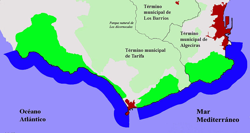
Campo de Gibraltar
It is south south, where two seas and two continents. The landscape is so unique that it two Natural Parks also bind: that of the Acorns and the Natural Park of the Strait.
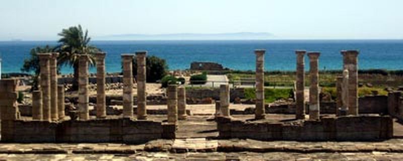
The region includes the coastal municipalities of Algeciras, La Linea de la Concepcion, San Roque and Tarifa, a walled city and Arabian style, famous for the sports of sailing and the Roman ruins of Baelo Claudia, nearby.
Inside, in the Natural Park of the Acorns, considered the best preserved forest in Europe worth visiting the villages of Jimena and Castellar de la Frontera, the first for its castle Roman-Arab and the second in its medieval fortress . Also the town of Alcalá de los Azules, declared a historic-artistic set, you must see if the area is covered.
Discover here all the attractions that offer the municipalities of the Campo de Gibraltar / The Acorns.
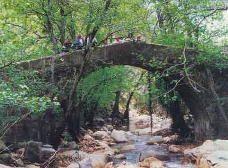
Puente Acueducto de los Baños de la Hedionda

Close to the Hedionda baths, and the Arroyo Albarrá Baths bridge appears. Built in the sixteenth century and restored in the eighteenth, is related to the irrigation ditch and pedestrian traffic between the two margins, especially among the Baths and the Way of Vallecillo, while serving aqueduct for general ditch water.
Construction on the next limestone Sierra de la Utrera, is made with two eyes on the river and a length of 45 meters, with a height above the normal river level 2 meters.
From airy structure, has nevertheless a notorious robustness in their basements that it has maintained to this day.
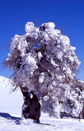
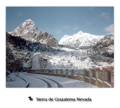
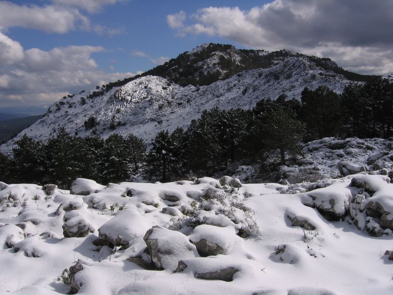
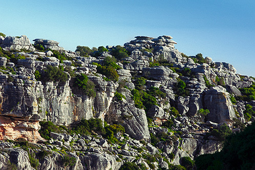
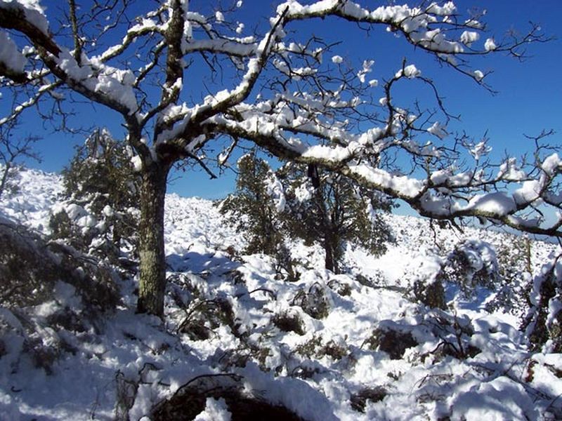
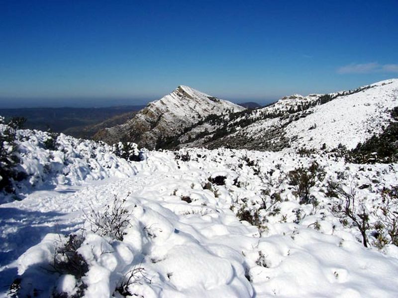
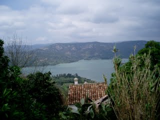
Parque Natural "Sierra de Grazalema"
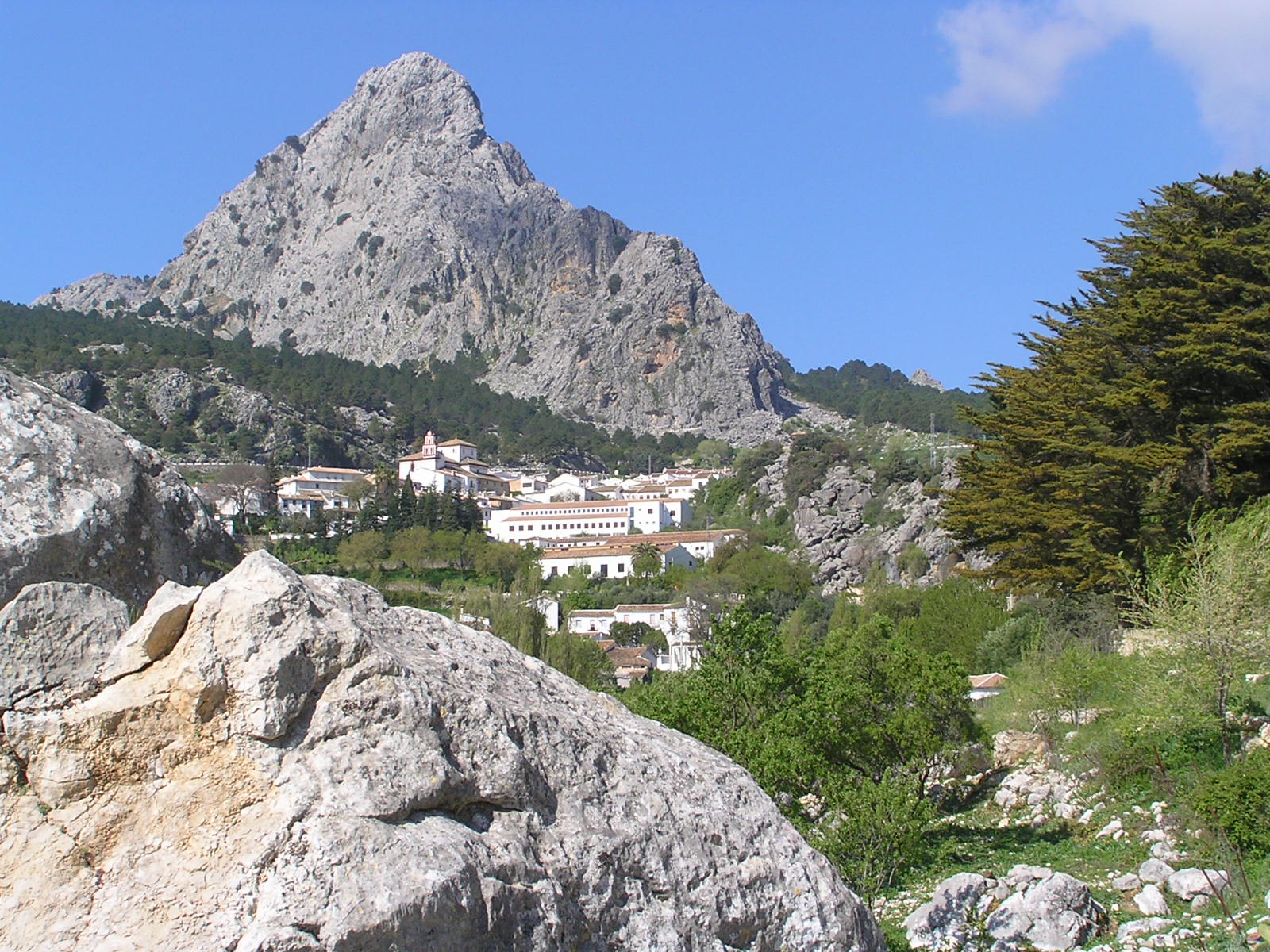
The Natural Park of the Sierra de Grazalema is located between the provinces of Cadiz and Malaga, in the westernmost part of the Betic Cordillera. Their heights are between 600 and 1,600 meters, and features spectacular formations like the Garganta Verde, the Hundidero complex - Cat, the cave of the sink or Salto del Cabrero.


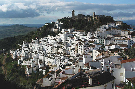
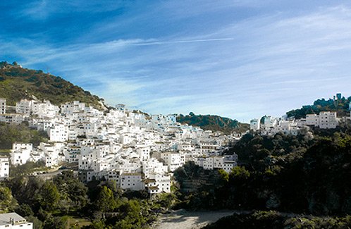
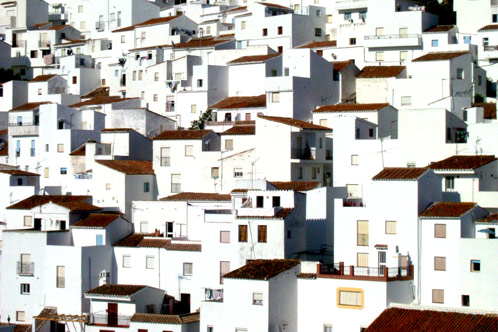
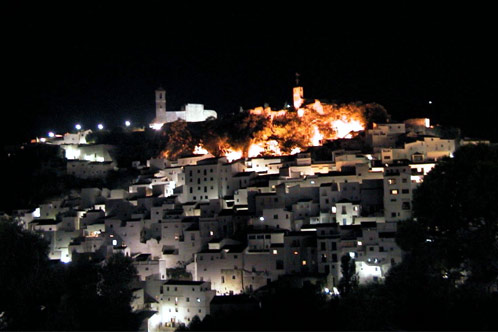
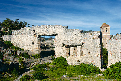
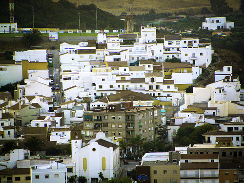
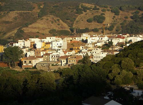
Casares
It is a small town in the western part of the Costa del Sol, in the province of Malaga. Like other municipalities, their life revolves around the sea and the mountains, with an urban and rural core found inside while on the coast also has its small coastline between Manilva and Estepona.
Casares is between Gaucin, Manilva and Estepona are the three municipalities that surround it, the limit of Malaga with the province of Cadiz. It is a small town of about 6000 habitanes whose population is split between the village, 430 meters above sea level and the coast.
It is a small town that was born in ancient times, the Phoenicians, and a town that has seen pass before his eyes to many civilizations centuries after centuries until today.
Places to visit:
Ruins of Arab Wall
Castle
Church of the Encarnación
Hermitage of the Vera Cruz
Etnohistory Museum
Church of the San Sebastián
Wellspring of Carlos III
Birthplace of Blas Infante

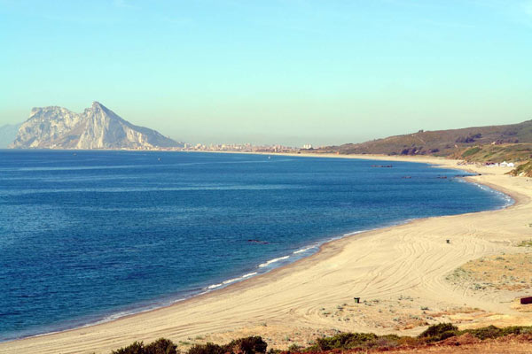
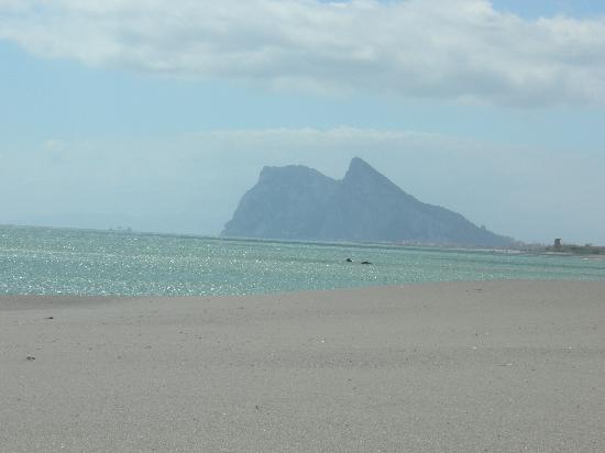
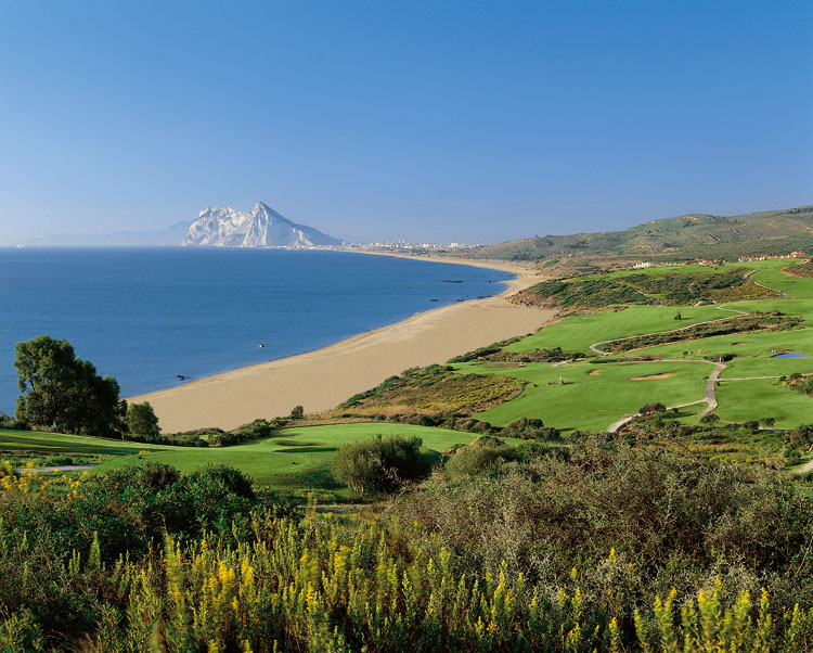
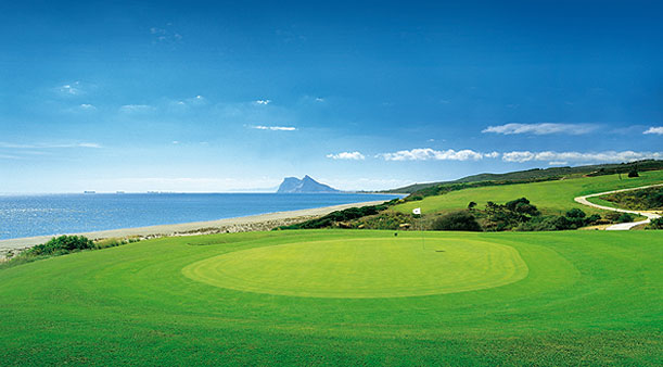
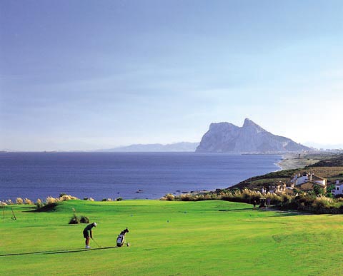
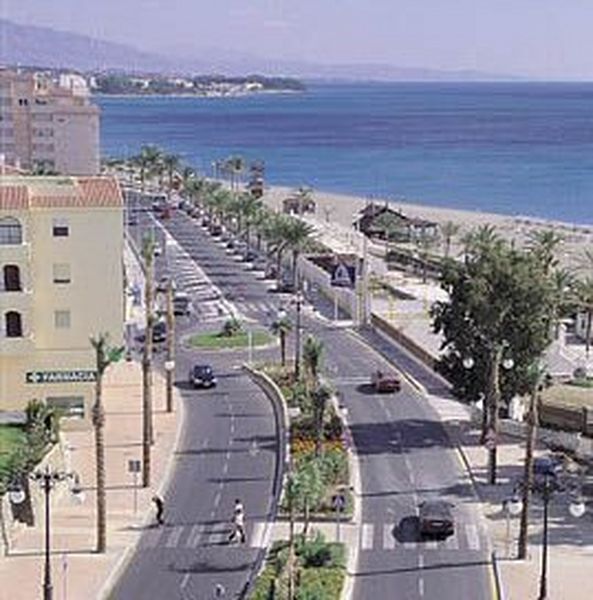
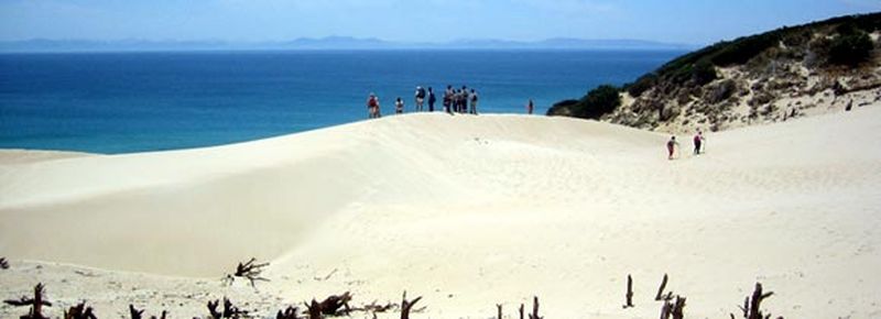
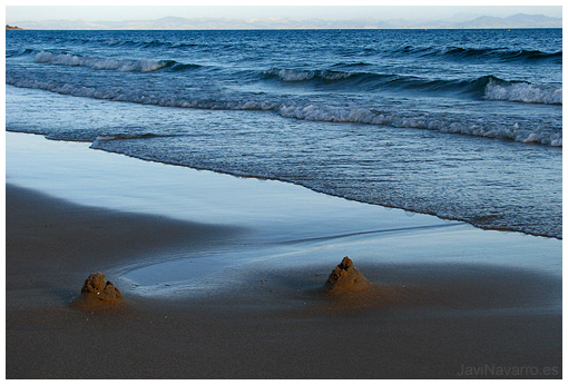
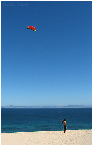
Playa de Alcaidesa
Little can be said when a picture is worth a thousand words ...
Alcaidesa besides having LF spectacular unspoilt beaches crystal clear waters with stunning views of the Mediterranean and Gibraltar, is located within the Natural Park of the Acorns.
To this we must add that features a unique golf course with 18 holes par 72 that limits the shore of the beach.

| Directions, |
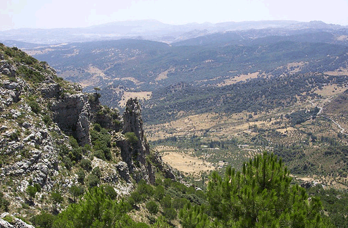
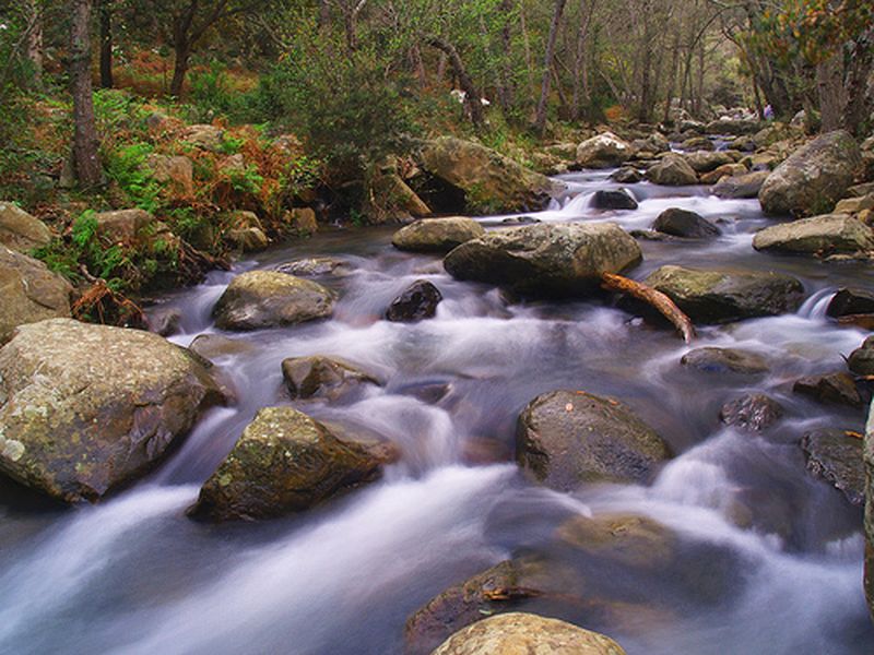
Parque Natural "Los Alcornocales"
The Acorns The Natural Park with an area of 167.767 ha and the third largest protected natural areas in Andalusia, is located at the western end of the Betic Cordillera in the province of Cádiz, except for the northeastern part of the province that Malaga. The municipalities belonging to the park and the province of Cádiz are: Alcalá de los Azules, Algar, Algeciras, Arcos de la Frontera, Benalup, Benaocaz, Castellar de la Frontera, El Bosque, Jerez de la Frontera, Jimena de la Frontera, Los Barrios, Medina Sidonia, Prado del Rey, San José del Valle, rate and Ubrique. And the town Cortes de la Frontera belonging to Malaga.
 |
 |
To the north is the Sierra de Grazalema Natural Park; the countryside west Cadiz; Depression southwest of Sierra de Janda and Fates; south borders the Strait of Gibraltar and the Campo de Gibraltar; southeast and east the valley of the River Guadiaro.
Its highest peak is the Pico of the cistern (1092 m.) And vegetation that characterizes it is the internodes, a forest of distinctive bank of these mountains, which is represented by the narrow valleys of the headwaters of mountain streams with vegetation that colonizes. Given its geographical location and diversity of ecosystems exist where we can find many migratory birds and animals such as the fox, badger, weasel, etc.
The natural attraction of this park does not end here, as it hosts a forest exceptional, capable of transporting a subtropical regions absent today from the European continent, to be formed by species typical of these environments found this place adequate shelter galleries to develop. Narrow "canutos" excavated by deep valleys and rivers are located in so-called.
Weather

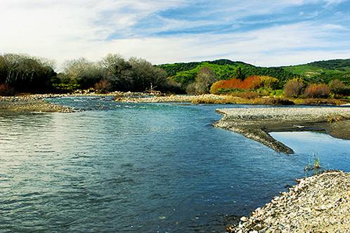
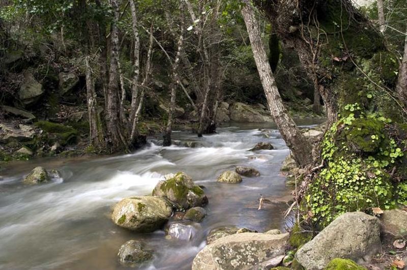
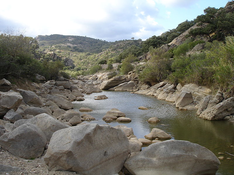
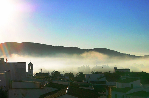
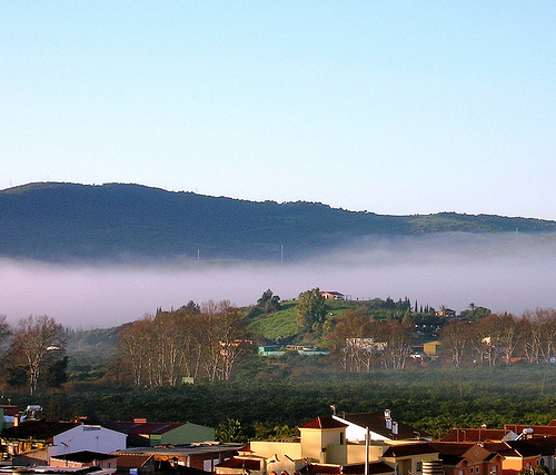
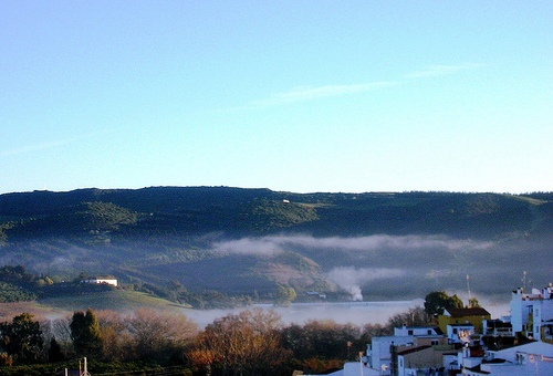
Río Hozgarganta cerca de
San Martín del Tesorillo
Given the geographical position of the Acorns, the dominant climate in the area is logically Mediterranean, but a number of factors contribute to singling. First, the proximity to the sea causes a dampening effect of temperature variation, keeping them soft and very consistent throughout the year. To this we must add annual rainfall exceeding almost 800 L / m², reaching in some areas over 1,400 thanks to the sweeping ocean fronts from west to east during the autumn, winter and spring. In the southern highlands, it should also be noted the presence of summer fog whiskers known as lift, which provide valuable horizontal humidity and rainfall in the long dry season characteristic of the Mediterranean climate. All these factors contribute to a special microclimate very similar to that in subtropical and Macaronesian regions, which favors the growth of a lush jungle vegetation, which has been the origin of the epithet given to the Acorns: the last Mediterranean forest.
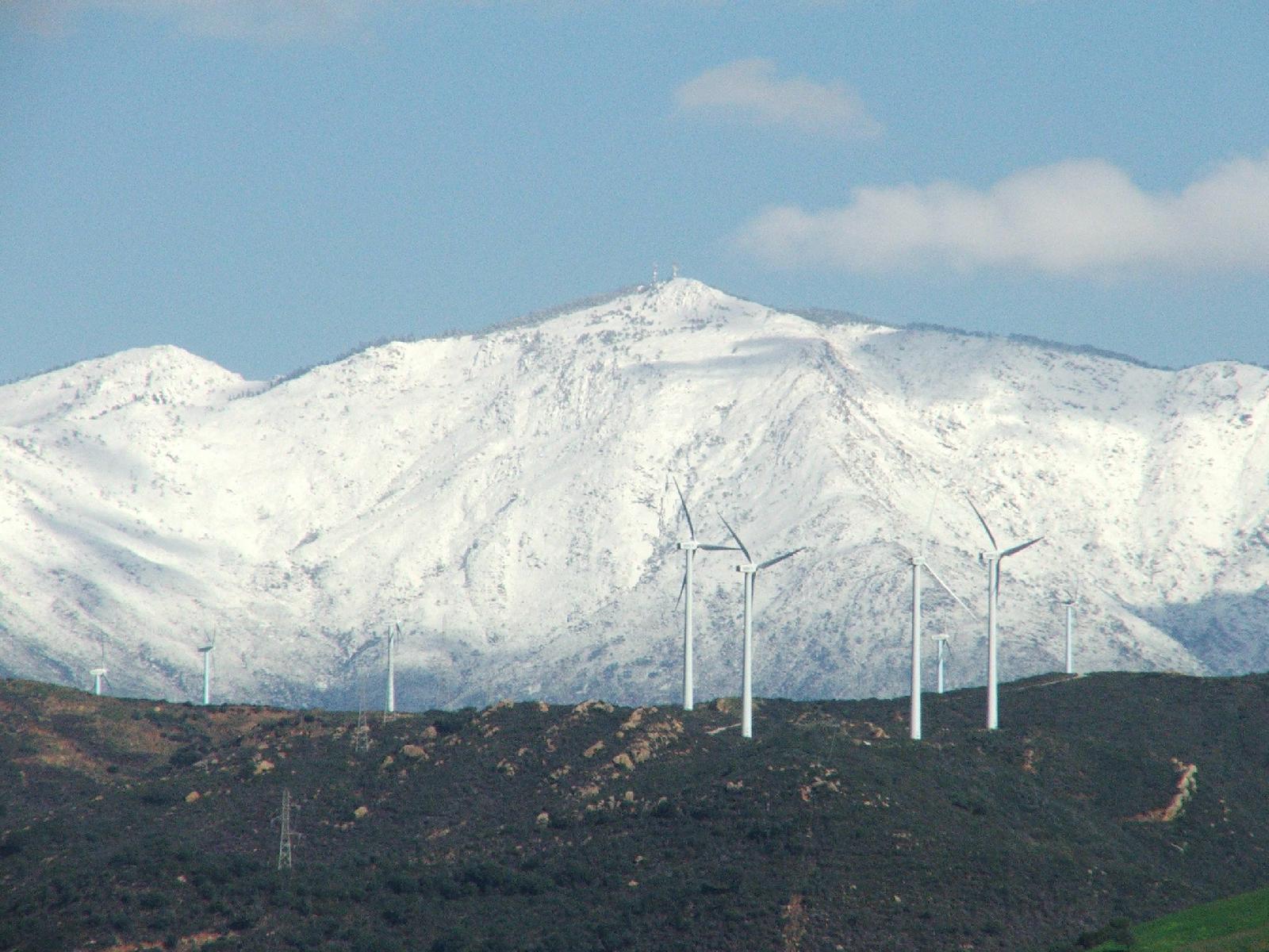
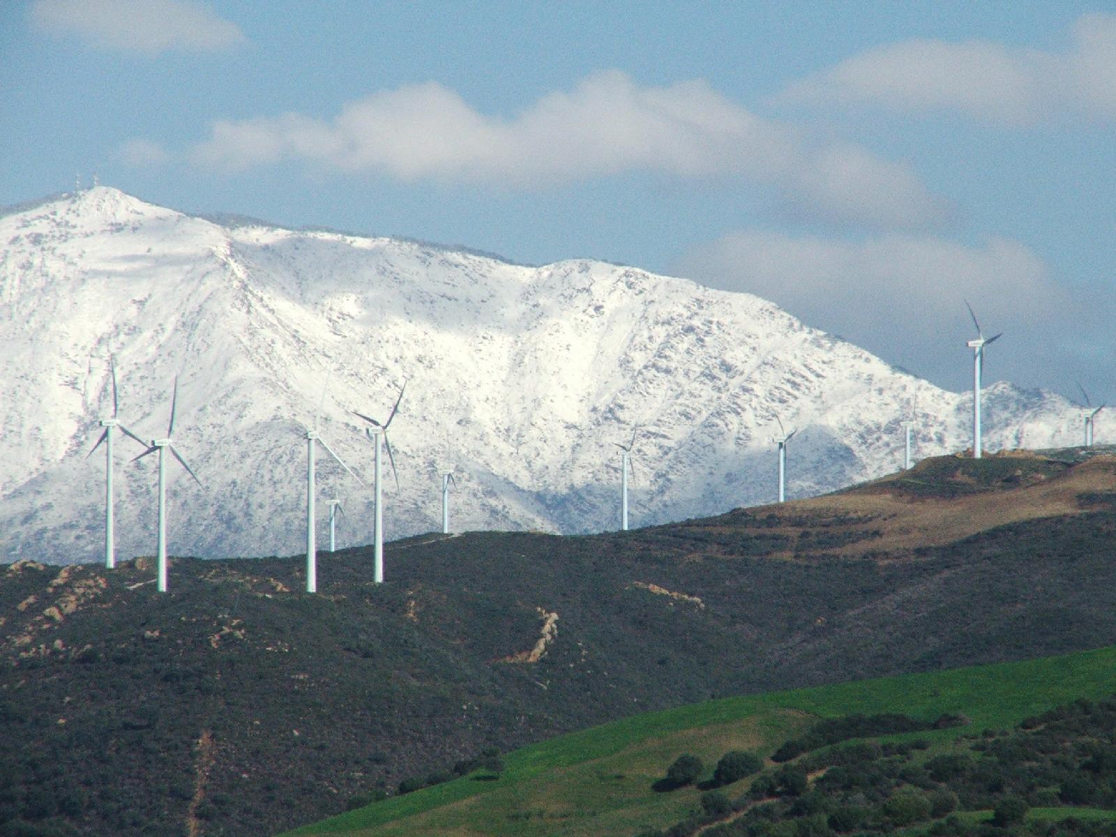
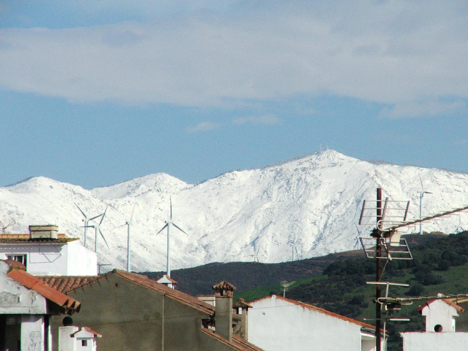
Wind is also a factor to be taken into account in the Park. The proximity of the Straits of Gibraltar and layout north-south of the coastal mountain ranges, affects their frequency and intensity, reaching reaching the highest values in the Iberian peninsula, proof of which is the existence of higher production field wind power in Spain.
Flora![]()

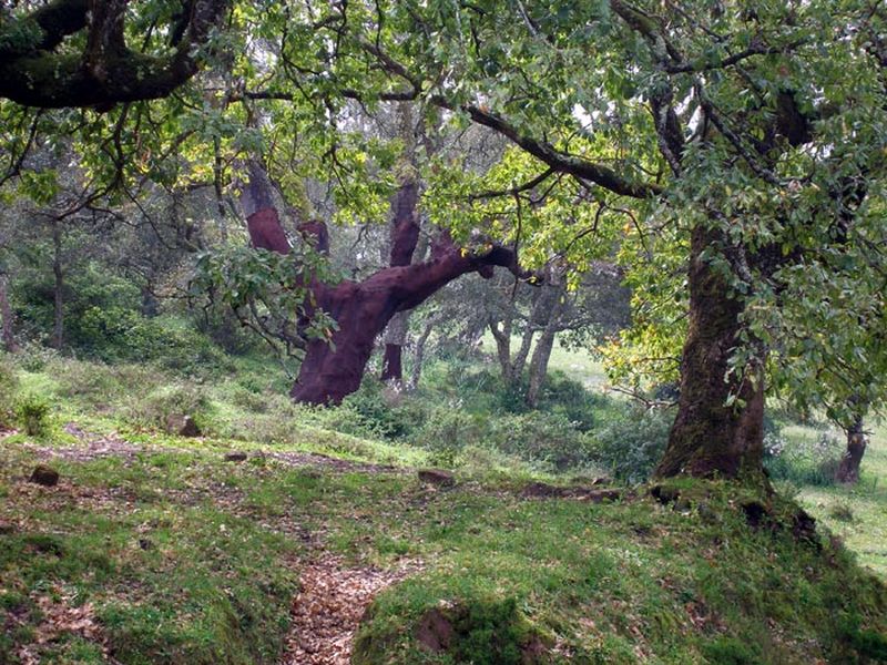
The park is characterized by forest oak largest in Spain and one of the largest in the world in an excellent state of preservation while maintaining the human use of cork. Unlike other cork oak forests latitudes where the thickness is low, the trees in this area are real forests accompanied by a rich and varied shrub and herbaceous vegetation in close connection, which ensures the natural regeneration of the forest, a good mix of ages and a floristic and faunal biodiversity very high.
But besides cork, the Park has represented other both qualitatively and quantitatively important forests. We should highlight the Andalusian forests oaks or oaks, remnants of the past that make forests of indescribable beauty, where environmental and soil moisture is the main character, with the trunks and branches colonized by lichens, mosses, ferns and epiphytes some higher plants that climb looking for the necessary light is scarce at ground level because of the high density of the cover and the size reached this tree leaves. It is also normal for the presence of other species typical of Mediterranean forests, as wild olive trees, and Pyrenean oak.
The terrain is relatively gentle mountains up to 1,000 meters above sea level, with some deep valleys called canutos in running small mountain streams, favoring the other main feature of the park and the most important plant community from a scientific point of view, some gallery forests or subtropical laurel forests which are unique in continental Europe, with presence of laurel, rhododendron, buckthorn, durum, alder, holly and fern accompanied by extremely rare in these latitudes, although this vegetation type occupied most central and southern Europe during the Tertiary. The Acorns has the honor of having several of its type canutos oldest vascular plant that lives on the earth, a fern that can only be found in various tropical areas of the world in remote areal several thousand kilometers of its European location.
Wildlife

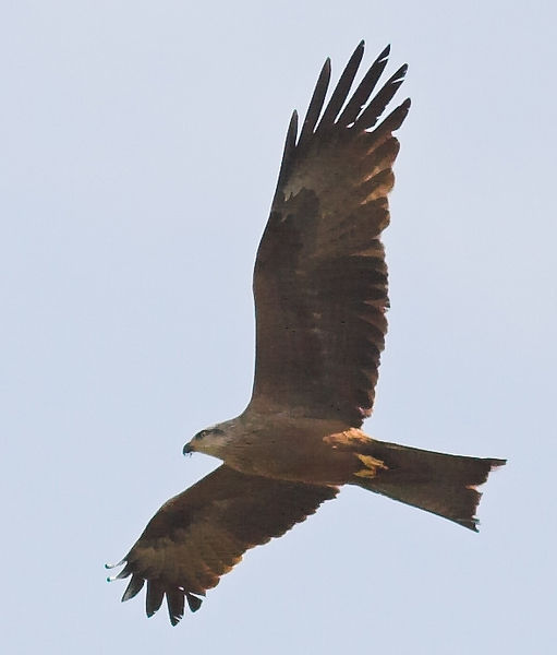
The rich fauna of the park is also largely determined by its geographical position. The position on the southernmost tip of Europe makes it required periodic passage to and from Africa, millions of migratory birds converge in this area on a seasonal foraging and a more benign climate for development. Therefore, the Acorns is a real paradise for birdwatchers who come year after year to watch the passing mainly of soaring birds: storks, kites, honey buzzard, booted eagle and short-toed, vultures, Egyptian vultures and endless many other birds that recover energy in the park or hope that the weather conditions are favorable for the always problematic passage of the Strait of Gibraltar.
Also important mammal populations for its variety and abundance. With any luck, in the Acorns can be observed-in the Park meloncillos the largest European populations of this Mongoose, genets, otters, polecats, weasels, wildcats and between carnivores and deer, ibex and roe deer are conserved among herbivores. These saws have the privilege of hosting the last population of deer Andalusian Moorish race called in the southwestern limit of the global distribution of the species. As for the Lynx, the current data are contradictory, but there may be some individuals in the most remote forests, away from human presence.
History

The Acorns is located in a strategic location, beside him join the Atlantic with the Mediterranean and, almost, Europe and Africa. The geographical position is one of the aspects that have marked the vicissitudes of his heritage, both natural, and cultural. Your settlement begins tens of thousands of years, as evidenced nearby archaeological sites belonging to Neanderthals, or the remains of engravings and paintings dating back to the Paleolithic and Neolithic. But are definitely wraps Bronze Age that attracted the most attention of the visitor. Of more than fifty existing caves, known for their artistic value and its unique themed Cave Tajo de las Figuras, considered the Sistine Chapel of the schematic rock art; Cueva de la Laja Alta, which houses a small catalog of the first ships that sailed the Mediterranean from the east; and Bacinete Cave, with over a hundred pictographs in excellent state of preservation.
After the first settlers, many settled in this space, overlapping cultures and civilizations, which have contributed a peculiar ethnological hue and a legacy of great wealth: megalithic monuments, Iberian remains, Phoenicians, Romans, Arabs strengths, etc. Many of the people who now make up the Natural Park peaked during the Moorish reign, when formed the western border of the Kingdom of Granada. Andalusíes still retain many features in its historical, helmets serrano typical white village. Jimena de la Frontera, Castellar de la Frontera and Medina Sidonia are great examples.
Landscapes

Among the most notable areas for their scenic interest may include:
-Pico Of The Cistern
It is the highest peak in the park, with 1,092 m.
-Pico El Picacho
It is the second peak of the park. Its top has a small flat terrain.
Other

The highest point of the natural park is located in the Pico del cistern, with 1,092 meters (just over Picacho). Both are located in the highlands of the cistern, between the town of Alcalá de los Azules and rural tourism complex of La Sauceda. [2]
Inside the park, near the town of Los Barrios is Montera Torero, a unique eroded sandstone rock formation with an uncanny resemblance to the typical hat of the bullfighters.

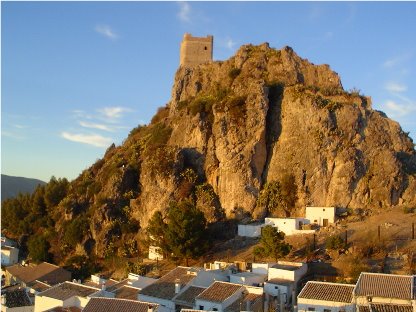
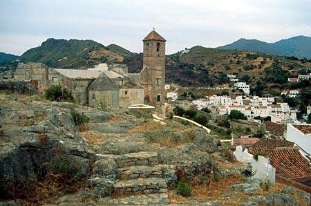
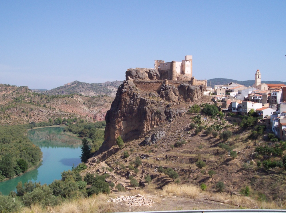
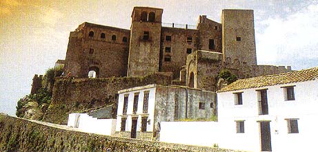
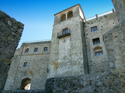
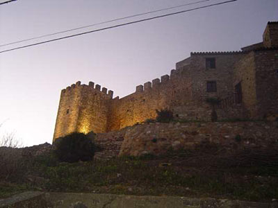
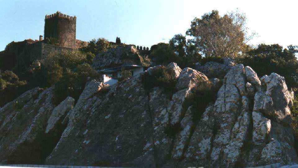
Castellar Castle
XII-XV century, very transformed over time, yet maintains its integrity made him a stronghold in the struggle of Christians against the Kingdom of Granada.
Heritage Site in 1963.
It is of irregular shape, forming a pentagon with unequal sides.
This is one of the few examples of medieval fortification that has remained inhabited until the present day.
Some of its elements correspond to the Christian era.
It sits on a rocky promontory, from which much of the Almoraima be seen, the reservoir Guadarranque and even Gibraltar and Ceuta. On the entrance to the Villa is the Alcazar.


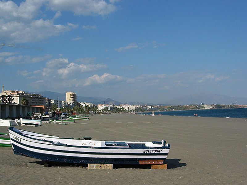
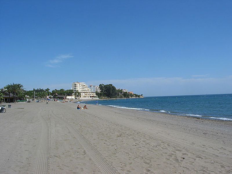
Estepona


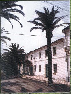
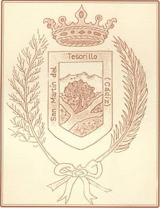
San Martín del Tesorillo
Privileged place ideal for rest situated between the mountains, the beach and in the river Guadiaro Guadiaro Valley.
Next to Sotogrande and major natural parks Cazorla, Grazalema Strait among others, is certainly the enchanted valley we have all ever thought.
At the foot of the Sierra de Ronda and bathed guadiaro Hozgarganta River and is the best place to visit if you're looking nature.
Surrounded by orange groves, golf and polo is ideal for rest and most desired by willing to rest under the best views of the Andalusian sky traveler entertainment.
Today is a Local Autonomous Entity, after many years of relying Jimena de la Frontera.
The entering San Martin del Tesorillo is illuminated by the Andalusian Burning, relaxation and immense option difrutar field, river and sea.
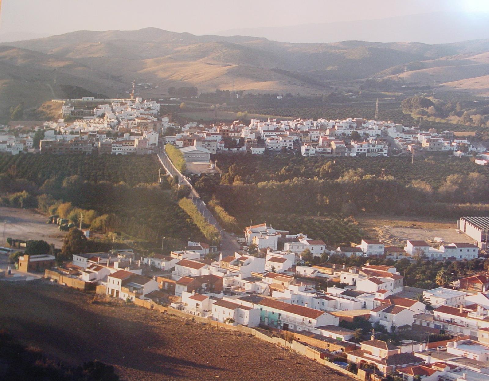
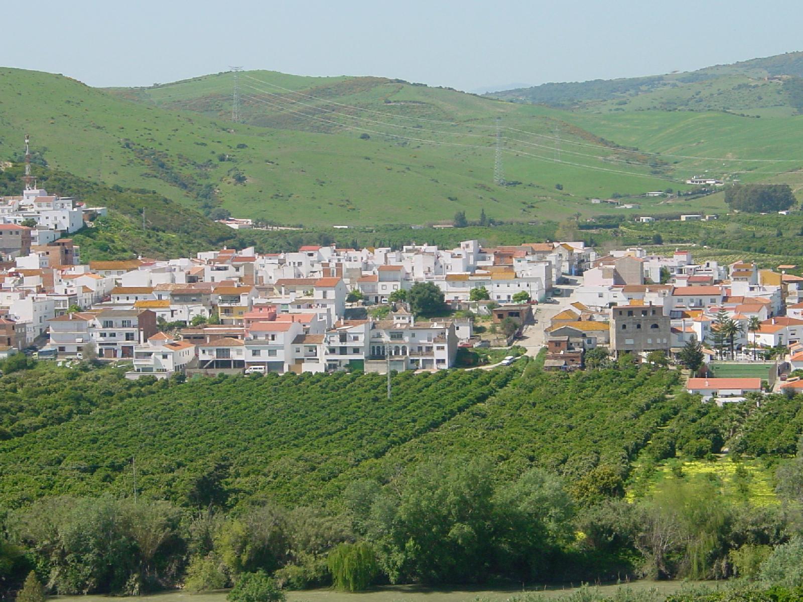

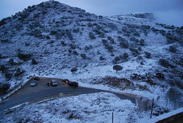
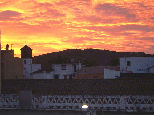
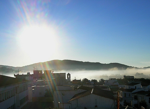
These are some of the espectaculare views of San Martin del Tesorillo at dawn, dusk ... and even though it is not often one year it snowed around.

Remarks:
- The appellation of its oranges, known as the 'Little Valencia'.
- Larga st
 |
 |
- The "Cottage" of the Marquis of Larios

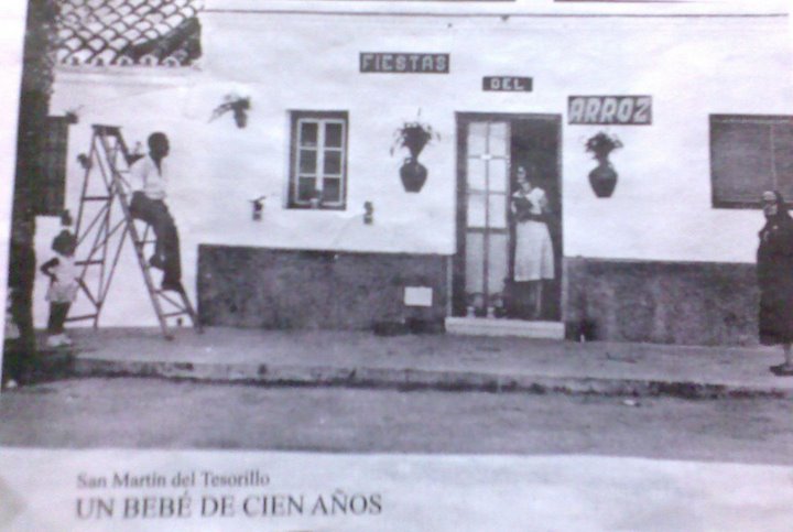
Celebrations:
-
The patron saint festivities are celebrated on the day of Corpus Christi in June.
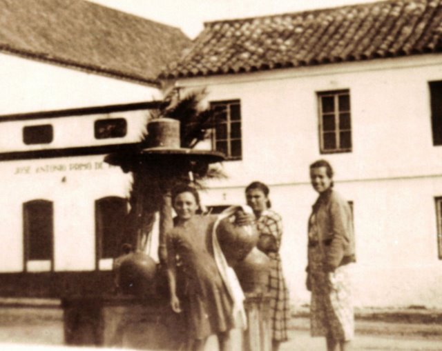
A little of history
The existence of human settlements in the area where today latches San Martin del Tesorillo is linked to the development of Guardiaro River. So in their proximidadeshan been found archaeological remains of Roman and Arabic cultures.
The founding of San Martín process is defined by the appearance of a series of facts.
On 20 November 1869 José Alvarez de Toledo y Silva, Duke of Medina Sidonia sells the Marquis de Larios several estates including the estate is Montenegral Under.
In 1872 the first irrigation canals are constructed and begin the first settlements in the area. This increase in the number of settlers has its effect in 1879, with the declaration and creation of the Rural Tesorillo Colony.
In 1882 the construction of new irrigation canals is authorized, this year also the home of the Larios family in Cologne is built.
Later in 1887 this farm joins with others in the Industrial and Agricultural Company Guadiaro (SIAG) going to be called Colonia SAN MARTIN DEL TESORILLO.

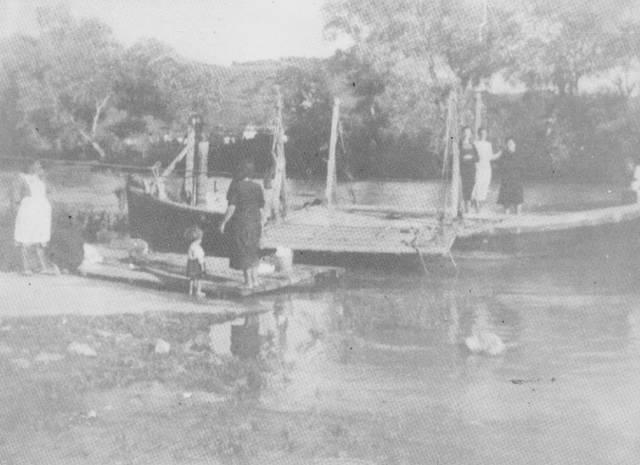
In front of San Martin del Tesorillo (Cádiz) is the Neighborhood of El Secadero (Málaga). The distance between them is only 700 meters away. Halfway find separating these two localities Guadirao river and back in the year 30, and the only way to cross the river was in this boat.
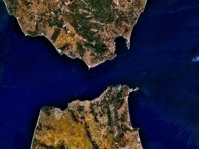
Parque Natural "El Estrecho"
The Natural Park of the Strait is located at the southern end of the Iberian Peninsula and protects the marine-terrestrial space coast from Cove Getares (Algeciras) to Cape Grace (Tarifa) was declared a natural park in 2003 and has a protected 18,910 ha. It is the southernmost protected cultural joins the European continent and ecological, scenic, historic and unique characteristics space. Part of the Transcontinental Biosphere Reserve of the Mediterranean.
 |
 |
| Vista de sátelite del Estrecho de Gibraltar | Parque Natural del Estrecho ámbito terrestre y marítimo |
The costs of the park are bathed by two seas, on the east by the Mediterranean Sea and on the west by the Atlantic Ocean. The Strait of Gibraltar, which links these seas that separates Europe and Africa, is a stopping point for migratory birds and marine mammals. The minimum distance between the two continents is only 14 km from prehistoric times and this step is also a flyway men.
The union of two seas becomes the marine environment in a prime location with exceptional biodiversity of extraordinary interest. The climate of the area is characterized by mild temperatures and a dry season with a total absence of rain.
Like all parks in Andalusia, has a management board and one advisory which is the Governing Board. Since its inception the conservative director of the park is Jesus Cabello Medina, forestry engineer, a career official from the Ministry of Environment. The Governing Board is chaired by Sena Ildefonso Rodriguez, journalist and teacher, re-elected in February 2008 for a second term.
Geology
The park is located in the foothills of the Betic Cordilleras, geologically corresponds to the geological unit Algeciras, which extends also to the north of Morocco, and orogenic terrains. The unit consists of Algeciras Flychs Margo arenicoso-micaceous-Oligocene-Early Miocene the postorogenic land are located in the western part of the park and are unique to the Quaternary, are mainly alluvial deposits.
The principal geological formations of the park are the mountains of El Bujeo and Kid; respect to coastal submarine karst stand.
Hydrology
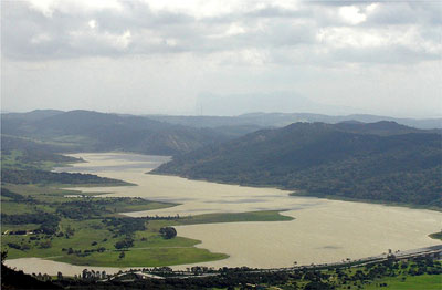
In eastern and due to the high slope of the mountains of El Bujeo there is no river wide entity, although several small rivers and runoff; between these rivers and the river Guadalmesí Marchenilla river valleys are highlighted; in the west the ground is lower and the Jara river located there and the Vega forming marshes at its mouth.
Flora and wildlife
  |
 |
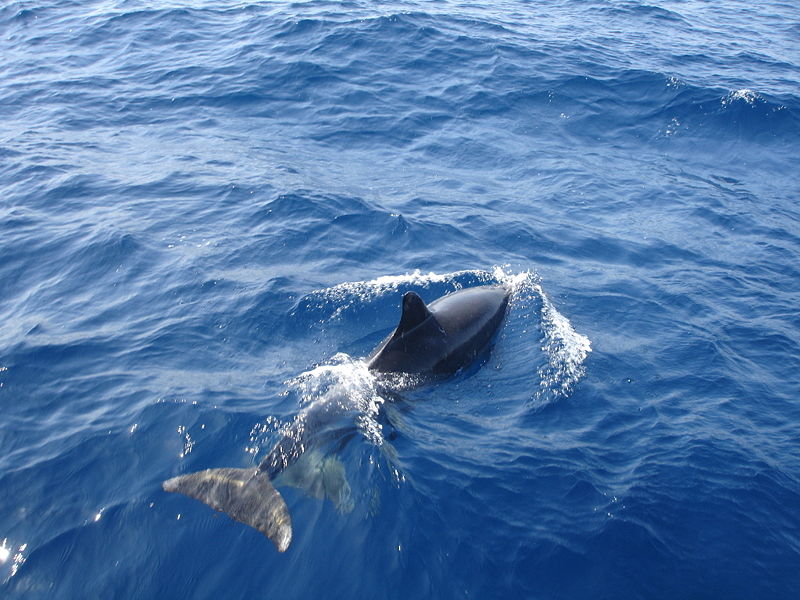
| Cetacean sighting | Milano |
Within the park you can find different ecosystems, each with its characteristic flora; Mediterranean scrubland is the most abundant, containing species such as palm, heather, mastic, argan, matagallo and other xerophytes species, cork oak forests are mainly in parts alternating with introduced Pinus species in riparian forests or canutos predominates along the rhododendron gall Andalusian or hornbeam and many species of ferns.
As for the fauna birds make their migration from Africa to Europe in number of tens of thousands. Are not abundant large mammals that are found in the nearby Natural Park of bedrooms due to the rugged terrain and the type of predominantly low vegetation, thereby itself can be found mongooses, genets and other small mammals.
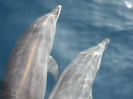
Regarding the flora and fauna have been found underwater meadows of angiosperms in several areas of the park though, because of the swing of the waves do not form large concentrations. The marine fauna is exceptionally narrow, numerous species of minke whales, bottlenose dolphins, killer whales, sperm whales, blue whales, etc.
Historia
Las pruebas más antiguas de la andadura humana por estas tierras corresponden a los restos neandertales encontrados en el Peñón de Gibraltar que corresponden a una de las últimas poblaciones mundiales de este grupo humano; respecto a los restos correspondientes al humano moderno los más antiguos de la zona son del Paleolítico Inferior. Existen también unas 34 cuevas y abrigos conocidos con arte rupestre y diversas estructuras funerarias y dolménicas representativo de los periodos, desde el Paleolítico de la Cueva del Moro hasta la Edad de Bronce de la Necrópolis de los Algarbes con sus enterramientos megalíticos de galería cubierta.
Posteriormente el territorio ha estado poblado por todas las civilizaciones de la zona, así, dentro de los límites del parque se encuentran yacimientos cartagineses como Cala Arena, romanos como Baelo Claudia o medievales como el Recinto del Cerro de la Horca o el Castillo de Tarifa.
Bajo las aguas del parque es posible localizar multitud de pecios principalmente de la edad moderna.
![]()
![]()
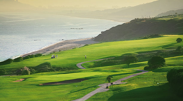
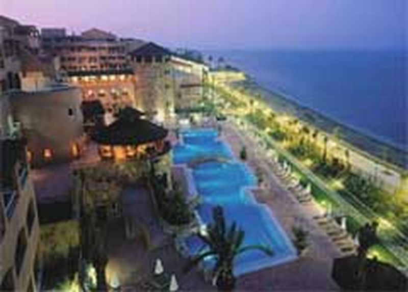
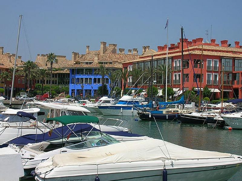
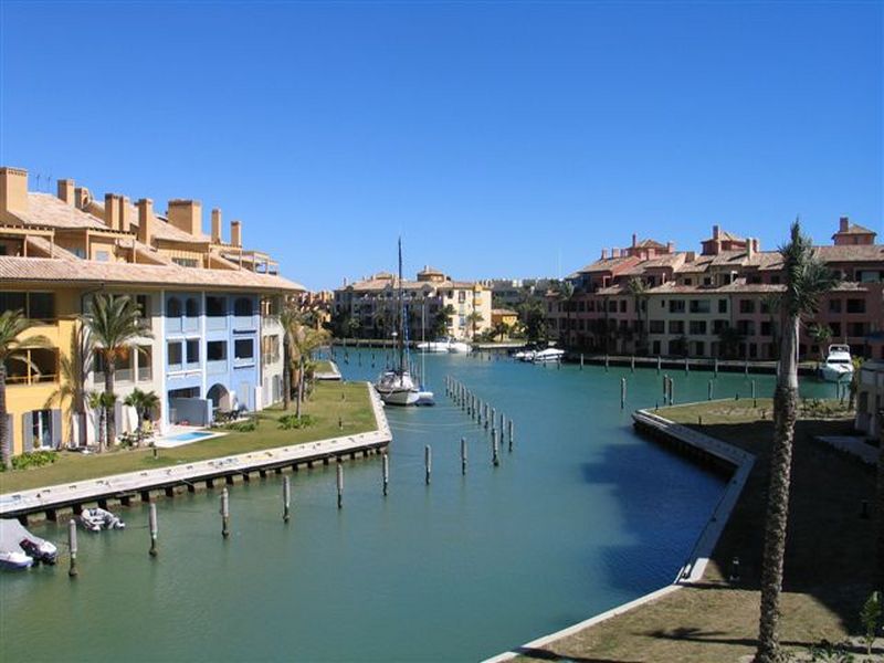
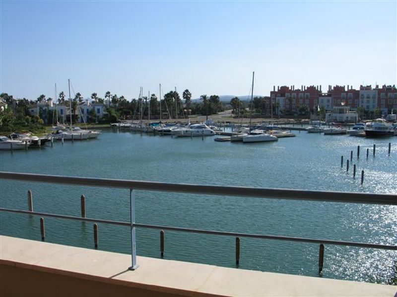
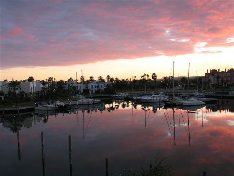
Sotogrande Marina
With a privileged location, Sotogrande place isa stylishly designed and inspired by a special way of understanding life.
Founded in 1962, Sotogrande is a place well connected with high-quality infrastructure and a warm climate all year round. Famous for its golf courses and polo fields, has become an exceptional place to enjoy its many charms all year round.
In its more than 2,000 hectares is to be encountered every imaginable comfort, wide avenues, a marina, two beach clubs, a multicolored Marina and all amenities such as restaurants, shops, facilities for all kinds of water sports...


Visit Review Site Coral www from this link.